Category:Roads in Suffolk
Jump to navigation
Jump to search
Ceremonial counties of England: Bedfordshire · Berkshire · Buckinghamshire · Cambridgeshire · Cheshire · Cornwall · Cumbria · Derbyshire · Devon · Dorset · Durham · East Riding of Yorkshire · East Sussex · Essex · Gloucestershire · Greater London · Greater Manchester · Hampshire · Herefordshire · Hertfordshire · Isle of Wight · Kent · Lancashire · Leicestershire · Lincolnshire · Merseyside · Norfolk · North Yorkshire · Northamptonshire · Northumberland · Nottinghamshire · Oxfordshire · Rutland · Shropshire · Somerset · South Yorkshire · Staffordshire · Suffolk · Surrey · Tyne and Wear · Warwickshire · West Midlands · West Sussex · West Yorkshire · Wiltshire · Worcestershire
City-counties: Bristol · City of London
Former historic counties: Huntingdonshire ·
Other former counties:
City-counties: Bristol · City of London
Former historic counties: Huntingdonshire ·
Other former counties:
Wikimedia category | |||||
| Upload media | |||||
| Instance of | |||||
|---|---|---|---|---|---|
| Category combines topics | |||||
| Suffolk | |||||
county of England      | |||||
| Instance of |
| ||||
| Location |
| ||||
| Capital | |||||
| Legislative body |
| ||||
| Population |
| ||||
| Area |
| ||||
| Different from | |||||
| Said to be the same as | Suffolk (historic county of England, ceremonial county of England, 1844) | ||||
| official website | |||||
 | |||||
Subcategories
This category has the following 44 subcategories, out of 44 total.
- Roads junctions in Suffolk (1 F)
A
B
- B1061 road (England) (10 F)
- B1068 road (England) (5 F)
- B1069 road (England) (4 F)
- B1074 road (England) (13 F)
- B1077 road (England) (60 F)
- B1078 road (England) (44 F)
- B1087 road (England) (4 F)
- B1106 road (England) (12 F)
- B1119 road (England) (40 F)
- B1120 road (England) (8 F)
- B1121 road (England) (35 F)
- B1123 road (England) (13 F)
- B1127 road (England) (3 F)
- B1375 road (England) (1 F)
C
D
- Dirt roads in Suffolk (24 F)
- Driveways in Suffolk (30 F)
F
G
- Green lanes in Suffolk (29 F)
L
P
R
S
- Snowy roads in Suffolk (7 F)
Media in category "Roads in Suffolk"
The following 200 files are in this category, out of 2,060 total.
(previous page) (next page)-
"Dual Carriageway", Hunston - geograph.org.uk - 409694.jpg 640 × 480; 101 KB
-
"Over the hill" - geograph.org.uk - 375048.jpg 479 × 640; 84 KB
-
'End Of The Road' Orford Ness - geograph.org.uk - 292812.jpg 640 × 480; 92 KB
-
A bridleway next to Little Park Farm - geograph.org.uk - 379554.jpg 640 × 443; 92 KB
-
A Footpath across a country road - geograph.org.uk - 407304.jpg 640 × 456; 111 KB
-
A1069 Church Rd Snape and Snape SPSO Postbox - geograph.org.uk - 1433106.jpg 3,072 × 2,304; 1.4 MB
-
A1069 Church Road, Snape - geograph.org.uk - 1433104.jpg 3,072 × 2,304; 1.52 MB
-
A1071 near Hadleigh - geograph.org.uk - 1438793.jpg 640 × 460; 98 KB
-
A1071 Woodbridge Road - geograph.org.uk - 1033412.jpg 3,072 × 2,304; 1.33 MB
-
A1088 south of Euston - geograph.org.uk - 180918.jpg 640 × 480; 106 KB
-
A1094 near Snape - geograph.org.uk - 177606.jpg 640 × 480; 98 KB
-
A1120 at Pettaugh - geograph.org.uk - 1081889.jpg 3,072 × 2,304; 1.29 MB
-
A1120 at Stonham Aspal, Suffolk.jpg 800 × 600; 86 KB
-
A1120 Peasenhall - geograph.org.uk - 1193557.jpg 3,072 × 2,304; 1.4 MB
-
A1189 Bixley Road, Ipswich - geograph.org.uk - 1186030.jpg 3,072 × 2,304; 1.48 MB
-
-
A12 London Road, Darsham - geograph.org.uk - 1440616.jpg 3,072 × 2,304; 1.33 MB
-
A12 London Road, Darsham - geograph.org.uk - 1440617.jpg 3,072 × 2,304; 1.38 MB
-
A12 Main Rd Darsham and The Stn Postbox no IP17 4607 - geograph.org.uk - 1405149.jpg 3,072 × 2,304; 1.62 MB
-
A12 Martlesham Bypass - geograph.org.uk - 906013.jpg 3,072 × 2,304; 1.24 MB
-
A12 Near Martlesham - geograph.org.uk - 324867.jpg 640 × 480; 62 KB
-
A12 Saxmundham Bypass - geograph.org.uk - 972513.jpg 3,072 × 2,304; 1.41 MB
-
A12 Saxmundham Bypass - geograph.org.uk - 972518.jpg 3,072 × 2,304; 1.35 MB
-
A12 Saxmundham Bypass, Kelsale Cum Carlton - geograph.org.uk - 1433047.jpg 3,072 × 2,304; 1.4 MB
-
A12 Stratford Corner, Stratford St..Andrew - geograph.org.uk - 1433048.jpg 3,072 × 2,304; 1.34 MB
-
A1214 Main Road, Kesgrave - geograph.org.uk - 1132487.jpg 3,072 × 2,304; 1.55 MB
-
A1214 Main Road, Kesgrave - geograph.org.uk - 1132517.jpg 3,072 × 2,304; 1.47 MB
-
A1214 Main Road, Kesgrave - geograph.org.uk - 1132555.jpg 3,072 × 2,304; 1.51 MB
-
A1214 Main Road, Martlesham - geograph.org.uk - 1163479.jpg 3,072 × 2,304; 1.43 MB
-
A1214 Main Road, Martlesham - geograph.org.uk - 1163486.jpg 3,072 × 2,304; 1.47 MB
-
A134 curving north through Alpheton - geograph.org.uk - 971172.jpg 640 × 469; 85 KB
-
A134 Northern Road - geograph.org.uk - 561221.jpg 640 × 480; 83 KB
-
A134, Northern Road - geograph.org.uk - 733525.jpg 640 × 480; 64 KB
-
A14 And Footpath - geograph.org.uk - 1404649.jpg 640 × 480; 100 KB
-
-
A14 from overbridge, Haughley - geograph.org.uk - 1581738.jpg 640 × 480; 71 KB
-
-
A14 passes over Fornham Road - geograph.org.uk - 1479645.jpg 640 × 481; 64 KB
-
A140 at the Magpie Public House - geograph.org.uk - 1118766.jpg 3,072 × 2,304; 1.32 MB
-
A144 Stone Street - geograph.org.uk - 233795.jpg 1,600 × 1,200; 372 KB
-
A144 Stone Street - geograph.org.uk - 233801.jpg 1,600 × 1,200; 354 KB
-
A144 Stone Street - Ilketshall St.Lawrence - geograph.org.uk - 257079.jpg 1,600 × 1,200; 393 KB
-
A14traffic.jpg 427 × 640; 78 KB
-
-
Aldham village sign - geograph.org.uk - 986498.jpg 640 × 480; 89 KB
-
Approaching Benhall Street - geograph.org.uk - 250663.jpg 1,600 × 1,200; 302 KB
-
Approaching Peasenhall on A1120 (looking east) - geograph.org.uk - 224047.jpg 1,600 × 1,200; 387 KB
-
Arboreal Gateway - geograph.org.uk - 543629.jpg 640 × 480; 71 KB
-
Asda roundabout takes shape - geograph.org.uk - 1181811.jpg 640 × 480; 76 KB
-
Ash Road, Wickham Market - geograph.org.uk - 1457703.jpg 3,072 × 2,304; 1.79 MB
-
Ash Road, Wickham Market - geograph.org.uk - 1501434.jpg 3,072 × 2,304; 1.54 MB
-
Autumnal road near Knodishall church. - geograph.org.uk - 1045314.jpg 640 × 480; 195 KB
-
B1066 entering Boxted from the north - geograph.org.uk - 971637.jpg 640 × 415; 79 KB
-
B1066 entering Boxted from the south - geograph.org.uk - 971699.jpg 640 × 401; 69 KB
-
-
B1069 Church Road, Snape - geograph.org.uk - 1448037.jpg 3,072 × 2,304; 1.4 MB
-
B1083 Looking South - geograph.org.uk - 551432.jpg 640 × 480; 109 KB
-
B1122 Leiston Road, Theberton - geograph.org.uk - 1202826.jpg 3,072 × 2,304; 1.51 MB
-
B1123 Halesworth Road - geograph.org.uk - 1096532.jpg 3,072 × 2,304; 1.3 MB
-
B1125 The Street, Westleton - geograph.org.uk - 1441646.jpg 3,072 × 2,304; 1.28 MB
-
B1127, A146 Roundabout, North Cove - geograph.org.uk - 439861.jpg 640 × 480; 59 KB
-
B1353 at Thorpeness - geograph.org.uk - 942606.jpg 640 × 480; 60 KB
-
Barton Mills - geograph.org.uk - 61718.jpg 640 × 480; 98 KB
-
Bealings Road, Kesgrave - geograph.org.uk - 473947.jpg 640 × 413; 50 KB
-
Bealings Road, Kesgrave - geograph.org.uk - 473948.jpg 640 × 416; 79 KB
-
Bend in road at Little Finborough - geograph.org.uk - 549577.jpg 640 × 302; 43 KB
-
-
Bixley Road Ipswich - geograph.org.uk - 287111.jpg 640 × 480; 69 KB
-
Blocked road, RAF Lakenheath - geograph.org.uk - 481835.jpg 640 × 427; 89 KB
-
Botany Lane Stratford St.Andrew - geograph.org.uk - 256482.jpg 1,600 × 1,200; 396 KB
-
Chapel At The Junction - geograph.org.uk - 292970.jpg 640 × 480; 149 KB
-
Brick Lane - geograph.org.uk - 331712.jpg 640 × 440; 82 KB
-
Bridleway - geograph.org.uk - 1303273.jpg 640 × 480; 138 KB
-
Bridleway - geograph.org.uk - 488359.jpg 640 × 480; 139 KB
-
Bridleway at Smithwood Green - geograph.org.uk - 286607.jpg 640 × 427; 56 KB
-
Bridleway on the outskirts of Beccles - geograph.org.uk - 222827.jpg 480 × 640; 100 KB
-
-
Bridleway to North Common - geograph.org.uk - 221423.jpg 640 × 427; 92 KB
-
Bridleway to North Common - geograph.org.uk - 221424.jpg 640 × 427; 101 KB
-
Bridleway to Rushbrook - geograph.org.uk - 245274.jpg 640 × 427; 75 KB
-
-
Bridleway, close to Arger Fen - geograph.org.uk - 373976.jpg 640 × 480; 109 KB
-
Brome Avenue Junction - geograph.org.uk - 1542322.jpg 640 × 480; 145 KB
-
-
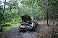 Burnt-out car on Little Ouse Path - geograph.org.uk - 517901.jpg 640 × 427; 142 KB
-
Bury To Sudbury - geograph.org.uk - 1291623.jpg 640 × 480; 111 KB
-
-
Byway at Great Green - geograph.org.uk - 243369.jpg 640 × 427; 75 KB
-
Byway at Knettishall - geograph.org.uk - 243337.jpg 640 × 427; 68 KB
-
Byway at Priory Green - geograph.org.uk - 593030.jpg 640 × 427; 149 KB
-
Byway junction - geograph.org.uk - 178920.jpg 640 × 480; 130 KB
-
Byway to Priory Green - geograph.org.uk - 593037.jpg 427 × 640; 145 KB
-
Cain's Hill, Boyton End - geograph.org.uk - 508311.jpg 640 × 427; 66 KB
-
Chapel Lane, Wickham Market - geograph.org.uk - 1503811.jpg 3,072 × 2,304; 1.41 MB
-
Chelsea Road - geograph.org.uk - 801175.jpg 640 × 480; 74 KB
-
Church Drive, Little Glemham - geograph.org.uk - 1452485.jpg 3,072 × 2,304; 1.46 MB
-
Church Lane - geograph.org.uk - 654596.jpg 640 × 480; 80 KB
-
Church Road, Little Glemham - geograph.org.uk - 1452481.jpg 3,072 × 2,304; 1.54 MB
-
Church Road, Little Glemham - geograph.org.uk - 1452483.jpg 3,072 × 2,304; 1.48 MB
-
Church Road, Little Glemham - geograph.org.uk - 1452513.jpg 3,072 × 2,304; 1.42 MB
-
Church Road, Little Glemham - geograph.org.uk - 1452514.jpg 3,072 × 2,304; 1.42 MB
-
Clicket Hill - geograph.org.uk - 800777.jpg 640 × 480; 91 KB
-
Cock and Bell Lane - geograph.org.uk - 691037.jpg 480 × 640; 81 KB
-
Coddenham Road, looking east - geograph.org.uk - 789478.jpg 640 × 481; 69 KB
-
-
Coram Street west of Hadleigh - geograph.org.uk - 1439043.jpg 640 × 457; 88 KB
-
Country lane at Parliament Heath (geograph 2041700).jpg 3,648 × 2,736; 1.65 MB
-
Country lane, Nowton - geograph.org.uk - 1256462.jpg 640 × 480; 85 KB
-
Country lane, Nowton - geograph.org.uk - 1256485.jpg 640 × 480; 97 KB
-
Country lane, Nowton - geograph.org.uk - 1256491.jpg 640 × 480; 102 KB
-
Country Road - geograph.org.uk - 2096994.jpg 1,200 × 1,600; 882 KB
-
Country road - geograph.org.uk - 902288.jpg 640 × 480; 66 KB
-
Country road near Shelley - geograph.org.uk - 275427.jpg 640 × 418; 62 KB
-
-
Creeting St.Peter - geograph.org.uk - 342288.jpg 640 × 480; 70 KB
-
Crop Spraying in Ufford Road - geograph.org.uk - 1029290.jpg 2,800 × 2,100; 809 KB
-
Crossing Brook Lane - geograph.org.uk - 396622.jpg 640 × 477; 129 KB
-
Crossing Road, Palgrave - geograph.org.uk - 4265736.jpg 3,072 × 2,304; 1.92 MB
-
Crossroad - geograph.org.uk - 979666.jpg 3,072 × 2,304; 1.5 MB
-
Crossroads - geograph.org.uk - 439493.jpg 640 × 481; 105 KB
-
Crossroads in Blaxhall - geograph.org.uk - 256521.jpg 1,600 × 1,200; 412 KB
-
-
Denham Road, heading towards Hoxne - geograph.org.uk - 349271.jpg 640 × 480; 81 KB
-
Detail of plastic kerb - geograph.org.uk - 1438614.jpg 640 × 480; 100 KB
-
Distant view - geograph.org.uk - 289375.jpg 480 × 640; 114 KB
-
Dobbs Lane looking north - geograph.org.uk - 327513.jpg 640 × 480; 118 KB
-
Down Mill Lane - geograph.org.uk - 1433452.jpg 640 × 480; 69 KB
-
Downham Highlodge Warren - geograph.org.uk - 516276.jpg 640 × 480; 112 KB
-
Driveway to Hall Farm, Rushbrooke - geograph.org.uk - 29442.jpg 640 × 427; 67 KB
-
Dunhill Lane, Hepworth - geograph.org.uk - 221427.jpg 640 × 427; 89 KB
-
Dunwich Heath - geograph.org.uk - 61238.jpg 424 × 640; 115 KB
-
Crinkle-crankle wall 1 - geograph.org.uk - 450546.jpg 640 × 480; 111 KB
-
Crinkle-crankle wall 2 - geograph.org.uk - 450547.jpg 640 × 480; 105 KB
-
Elden's Lane - geograph.org.uk - 388455.jpg 640 × 427; 57 KB
-
End of the road, Westley - geograph.org.uk - 1435793.jpg 640 × 481; 95 KB
-
Entering Long Thurlow - geograph.org.uk - 1509599.jpg 640 × 480; 85 KB
-
Entering Sibton - geograph.org.uk - 1064392.jpg 3,072 × 2,304; 1.4 MB
-
Entrance to Rougham Park Estate - geograph.org.uk - 245462.jpg 640 × 427; 118 KB
-
Entrance to Woodlands Hall Farm - geograph.org.uk - 276350.jpg 640 × 480; 107 KB
-
Euston Park - geograph.org.uk - 219786.jpg 640 × 427; 69 KB
-
Evening sunlight in Southwold. - geograph.org.uk - 656568.jpg 640 × 427; 88 KB
-
Fairfield Road, Saxmundham - geograph.org.uk - 1242923.jpg 3,072 × 2,304; 1.47 MB
-
Farm road east of Methwold - geograph.org.uk - 397578.jpg 640 × 480; 88 KB
-
-
Ferry Road - geograph.org.uk - 518049.jpg 640 × 480; 80 KB
-
-
Flooded road near Dale Farm, Wantisden - geograph.org.uk - 478620.jpg 640 × 426; 127 KB
-
Footbridge just east of Wetherden church - geograph.org.uk - 744960.jpg 456 × 640; 130 KB
-
Footpath - geograph.org.uk - 367042.jpg 640 × 417; 57 KB
-
Footpath along River Lark - geograph.org.uk - 641332.jpg 640 × 427; 113 KB
-
Footpath at Assington Green - geograph.org.uk - 203551.jpg 640 × 427; 101 KB
-
Footpath at Brickhouse Farm - geograph.org.uk - 193710.jpg 640 × 427; 103 KB
-
Footpath at Britton's Farm - geograph.org.uk - 193717.jpg 640 × 427; 108 KB
-
Footpath at Clopton Green - geograph.org.uk - 193655.jpg 640 × 427; 60 KB
-
Footpath at Fern Hill - geograph.org.uk - 198164.jpg 640 × 427; 82 KB
-
Footpath at Gosland Green - geograph.org.uk - 203545.jpg 640 × 427; 97 KB
-
Footpath at Langham - geograph.org.uk - 216981.jpg 640 × 427; 136 KB
-
Footpath at Melon Green - geograph.org.uk - 193805.jpg 427 × 640; 107 KB
-
Footpath at Park Gate, Wickhambrook - geograph.org.uk - 190135.jpg 640 × 427; 146 KB
-
Footpath at Risby - geograph.org.uk - 33562.jpg 427 × 640; 90 KB
-
Footpath at Scoles Gate - geograph.org.uk - 193708.jpg 640 × 427; 77 KB
-
Footpath at St Peter South Elmham - geograph.org.uk - 245074.jpg 640 × 427; 95 KB
-
Footpath at Stowlangtoft - geograph.org.uk - 216988.jpg 640 × 427; 116 KB
-
Footpath between Great Saxham and Risby - geograph.org.uk - 35090.jpg 640 × 427; 109 KB
-
Footpath between Rede and Pound Green - geograph.org.uk - 193705.jpg 640 × 427; 103 KB
-
Footpath crossing - geograph.org.uk - 192232.jpg 640 × 480; 135 KB
-
-
Footpath from Clopton Green to Rede. - geograph.org.uk - 193658.jpg 640 × 427; 68 KB
-
Footpath from Great Livermere to Ixworth - geograph.org.uk - 116631.jpg 640 × 480; 101 KB
-
Footpath in autumn - geograph.org.uk - 586603.jpg 486 × 640; 168 KB
-
Footpath in the gloaming - geograph.org.uk - 591869.jpg 640 × 480; 144 KB
-
Footpath junction near Snape Warren - geograph.org.uk - 229418.jpg 640 × 480; 144 KB
-
Footpath junction near Thorpeness - geograph.org.uk - 194032.jpg 640 × 480; 90 KB
-
Footpath near Boyton End - geograph.org.uk - 394237.jpg 640 × 426; 144 KB
-
Footpath near Cresslands Farm - geograph.org.uk - 193713.jpg 640 × 427; 87 KB
-
Footpath near Edwardstone - geograph.org.uk - 185483.jpg 480 × 640; 99 KB
-
Footpath near Little Waldingfield - geograph.org.uk - 185476.jpg 480 × 640; 99 KB
-
Footpath near Sudbourne Church - geograph.org.uk - 185038.jpg 640 × 480; 101 KB
-
Footpath near Tuddenham St. Martin - geograph.org.uk - 170458.jpg 640 × 480; 151 KB
-
Footpath through Livermere Park - geograph.org.uk - 632836.jpg 640 × 411; 63 KB
-
Footpath to Acton - geograph.org.uk - 186708.jpg 640 × 480; 86 KB
-
Footpath to Ashfield Green - geograph.org.uk - 186943.jpg 640 × 480; 113 KB
-
Footpath to Attleton Green - geograph.org.uk - 190127.jpg 640 × 427; 96 KB
-
Footpath to Badmondisfield Hall - geograph.org.uk - 190136.jpg 427 × 640; 100 KB
-
Footpath to Barrow in Suffolk - geograph.org.uk - 35205.jpg 640 × 427; 72 KB
-
Footpath to Boxted - geograph.org.uk - 195843.jpg 640 × 427; 66 KB
-
Footpath to Boxted - geograph.org.uk - 198153.jpg 427 × 640; 117 KB
-
Footpath to Boyden End - geograph.org.uk - 190122.jpg 640 × 427; 78 KB
-
Footpath to Bradfield Combust - geograph.org.uk - 199330.jpg 640 × 427; 70 KB
-
Footpath to Cavenham - geograph.org.uk - 38471.jpg 640 × 427; 57 KB
-
Footpath to Chevington Hall Farm - geograph.org.uk - 178913.jpg 640 × 480; 91 KB
-
Footpath to Cinque Farm - geograph.org.uk - 212244.jpg 640 × 427; 115 KB
-
Footpath to Cock Lane - geograph.org.uk - 201833.jpg 640 × 427; 136 KB
-
Footpath to Cockfield - geograph.org.uk - 199092.jpg 640 × 427; 88 KB
-
Footpath to Cocks Green - geograph.org.uk - 193825.jpg 640 × 427; 103 KB
-
Footpath To Cowper's Wood - geograph.org.uk - 542176.jpg 640 × 480; 124 KB
-
Footpath to Cropley Grove - geograph.org.uk - 189229.jpg 472 × 640; 99 KB
-
Footpath to Cross Green - geograph.org.uk - 195836.jpg 640 × 427; 74 KB
-
-
Footpath to Culford - geograph.org.uk - 200659.jpg 640 × 427; 69 KB


