Category:King Street (Roman road)
Jump to navigation
Jump to search
road between the City of Peterborough and South Kesteven in Lincolnshire | |||||
| Upload media | |||||
| Instance of | |||||
|---|---|---|---|---|---|
| Location |
| ||||
 | |||||
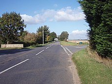
English: King Street (Roman road) — the modern name for the route of an Ancient Roman road in present day England.
- It runs on a a number of alignments in modern Cambridgeshire & Lincolnshire, eastern England — between Water Newton and Ancaster.
Media in category "King Street (Roman road)"
The following 23 files are in this category, out of 23 total.
- Course of Roman Road, Hanthorpe - geograph.org.uk - 590554.jpg 640 × 480; 60 KB
- King Street - geograph.org.uk - 1567050.jpg 640 × 426; 72 KB
- King Street - geograph.org.uk - 197041.jpg 640 × 427; 63 KB
- King Street - geograph.org.uk - 967658.jpg 640 × 480; 69 KB
- King Street near Ancaster - geograph.org.uk - 208784.jpg 640 × 427; 60 KB
- King Street West Deeping-Geograph-1516656-by-Paul-Bragg.jpg 640 × 427; 120 KB
- King Street, Hanby, Lincolnshire - Geograph-329748.jpg 640 × 427; 90 KB
- King Street, West Deeping.jpg 3,513 × 2,345; 2.4 MB
- Long Hollow near Braceby - geograph.org.uk - 155207.jpg 640 × 427; 122 KB
- Short Hollow near Braceby - geograph.org.uk - 155269.jpg 640 × 427; 117 KB
- The last house in Hanby - geograph.org.uk - 329760.jpg 640 × 427; 59 KB
- Farm track near Keisby House - geograph.org.uk - 600970.jpg 640 × 427; 79 KB
- King Street - geograph.org.uk - 717690.jpg 640 × 360; 63 KB
- King Street Lane - geograph.org.uk - 594122.jpg 640 × 427; 82 KB
- King Street Lane, near Stonesby - geograph.org.uk - 77521.jpg 480 × 640; 164 KB
- King Street, Hanby - geograph.org.uk - 329786.jpg 640 × 427; 78 KB
- King Street, Helpston, Peterborough - geograph.org.uk - 87481.jpg 640 × 480; 387 KB
- The A530 King street, nr Northwich. - geograph.org.uk - 358199.jpg 640 × 480; 97 KB


