Category:North Kesteven District
Jump to navigation
Jump to search
non-metropolitan district in East Midlands, England | |||
| Upload media | |||
| Instance of | non-metropolitan district | ||
|---|---|---|---|
| Location | Lincolnshire, East Midlands, England | ||
| Capital | |||
| Legislative body |
| ||
| Inception |
| ||
| Population |
| ||
| Area |
| ||
| official website | |||
 | |||
| |||
Subcategories
This category has the following 77 subcategories, out of 77 total.
A
B
- Burton Pedwardine (55 F)
C
D
E
G
H
K
L
- Little Hale (31 F)
M
N
O
P
R
- Roxholm (20 F)
S
T
W
- Witham St Hughs (52 F)
Media in category "North Kesteven District"
The following 200 files are in this category, out of 582 total.
(previous page) (next page)- 3 Stripes - geograph.org.uk - 476078.jpg 640 × 427; 56 KB
- A field of beans from the bridleway - geograph.org.uk - 412536.jpg 640 × 480; 129 KB
- A17 bridge over the river Slea - geograph.org.uk - 627458.jpg 640 × 480; 98 KB
- A17 Convoy - geograph.org.uk - 359299.jpg 640 × 480; 84 KB
- A17 from Newark - geograph.org.uk - 389982.jpg 640 × 439; 54 KB
- A17 Layby - geograph.org.uk - 264937.jpg 640 × 480; 109 KB
- A52 at Nightingale - geograph.org.uk - 1404515.jpg 640 × 480; 53 KB
- A52 Eastbound - geograph.org.uk - 1404510.jpg 640 × 480; 45 KB
- A536 Macclesfield Road, Eaton - geograph.org.uk - 1478440.jpg 640 × 601; 84 KB
- AA Box 446 - geograph.org.uk - 1044169.jpg 480 × 640; 123 KB
- Afternoon munch - geograph.org.uk - 421745.jpg 640 × 480; 79 KB
- Animal Bedding - geograph.org.uk - 378866.jpg 640 × 388; 47 KB
- As trains Pass - geograph.org.uk - 374726.jpg 640 × 442; 44 KB
- Bass Western Port 200 re-enactment.JPG 2,560 × 1,920; 2.89 MB
- Bass-Flinders Westernport discovery memorial.JPG 1,920 × 2,560; 2.55 MB
- Below the Escarpment - geograph.org.uk - 360095.jpg 640 × 498; 88 KB
- Boiling Wells Farm - geograph.org.uk - 374747.jpg 640 × 472; 45 KB
- Bone Mill Lock, River Slea - geograph.org.uk - 334455.jpg 640 × 427; 132 KB
- Bridge over ditch - geograph.org.uk - 390769.jpg 640 × 480; 108 KB
- Busy Bee and Bicycle Tale - geograph.org.uk - 494566.jpg 640 × 480; 69 KB
- Cobbler's Lock - geograph.org.uk - 546429.jpg 640 × 480; 148 KB
- Cobblers lock chamber and weir - geograph.org.uk - 627943.jpg 640 × 480; 95 KB
- Crossing and Box - geograph.org.uk - 258840.jpg 640 × 480; 94 KB
- End of public maintainable highway - geograph.org.uk - 390775.jpg 640 × 480; 52 KB
- End of the path - geograph.org.uk - 412538.jpg 640 × 480; 121 KB
- Farm buildings - geograph.org.uk - 390935.jpg 640 × 480; 62 KB
- Farm track through rape - geograph.org.uk - 389742.jpg 640 × 427; 110 KB
- Farmland east of Culverthorpe - geograph.org.uk - 394694.jpg 640 × 480; 74 KB
- Footbridge over River Brant - geograph.org.uk - 514809.jpg 640 × 480; 125 KB
- Footpath leading to A 15 - geograph.org.uk - 360551.jpg 640 × 480; 110 KB
- Free range poultry farming near Walcott - geograph.org.uk - 420932.jpg 640 × 427; 122 KB
- Getton's Lane - geograph.org.uk - 429539.jpg 640 × 480; 82 KB
- Greetwell Quarry - geograph.org.uk - 605830.jpg 640 × 426; 91 KB
- Greylees - panoramio (1).jpg 2,816 × 2,112; 2.93 MB
- Greylees - panoramio (2).jpg 2,816 × 2,112; 2.78 MB
- Greylees - panoramio (3).jpg 2,816 × 2,112; 2.44 MB
- Greylees - panoramio.jpg 2,816 × 2,112; 3 MB
- Greylees railway St. - panoramio.jpg 2,816 × 2,112; 2.14 MB
- Hedged field - geograph.org.uk - 378883.jpg 640 × 472; 90 KB
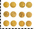
- Hoard of Spanish-American Doubloons.jpg 6,460 × 5,604; 4.87 MB
- Hykeham Bridge - geograph.org.uk - 502331.jpg 640 × 427; 61 KB
- LincolnshireNorthKesteven.png 200 × 265; 16 KB
- Lines to Newark - geograph.org.uk - 361342.jpg 640 × 427; 90 KB
- Martin Fen Grain stores - geograph.org.uk - 418302.jpg 640 × 427; 121 KB
- Martin Fen, B1191 - geograph.org.uk - 418299.jpg 640 × 427; 141 KB
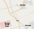
- Nocton Heath Farm map.svg 634 × 552; 81 KB
- Nocton Rise - geograph.org.uk - 353040.jpg 640 × 427; 48 KB
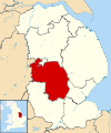
- North Kesteven UK locator map.svg 1,086 × 1,305; 1.27 MB
- North Kesteven UK ward map 2010 (blank).svg 1,218 × 1,306; 503 KB
- Old river Slea leaves the Slea navigation - geograph.org.uk - 628518.jpg 640 × 480; 116 KB
- Permissive footpath by the River Slea - geograph.org.uk - 782035.jpg 640 × 480; 118 KB
- Pump house and sluice gate - geograph.org.uk - 734126.jpg 640 × 427; 218 KB
- Railway near Helpringham - geograph.org.uk - 349193.jpg 640 × 451; 126 KB
- Rainbow over Gateway park - geograph.org.uk - 628089.jpg 640 × 426; 49 KB
- River Witham Reflection - geograph.org.uk - 624783.jpg 640 × 426; 131 KB
- Rollers - geograph.org.uk - 283970.jpg 427 × 640; 91 KB
- Sharpe's Warehouse - geograph.org.uk - 475848.jpg 640 × 427; 75 KB
- Silk Willoughby - panoramio (1).jpg 2,816 × 2,112; 3.04 MB
- Somerton Gate Lane - geograph.org.uk - 327112.jpg 640 × 427; 103 KB
- South Beck and Willoughby Road - geograph.org.uk - 336688.jpg 640 × 427; 105 KB
- South Beck near Osbournby - geograph.org.uk - 336222.jpg 640 × 427; 91 KB
- Spanby - geograph.org.uk - 588609.jpg 640 × 427; 76 KB
- Stile on Stow Lane - geograph.org.uk - 336254.jpg 640 × 427; 87 KB
- Stow Green Hill - geograph.org.uk - 1034236.jpg 640 × 427; 73 KB
- Stow Green Hill - geograph.org.uk - 336993.jpg 640 × 427; 80 KB
- Stow Lane near Threekingham - geograph.org.uk - 336995.jpg 640 × 427; 87 KB
- Sutton Road leads to Sutton^ - geograph.org.uk - 389797.jpg 480 × 640; 142 KB
- Swans on the River Slea - geograph.org.uk - 545931.jpg 480 × 640; 97 KB
- Timber-drying kilns, Billinghay Sawmills - geograph.org.uk - 421001.jpg 640 × 427; 142 KB
- Welcome to Aunsby - geograph.org.uk - 373639.jpg 640 × 480; 73 KB
- A Glint of Sun - geograph.org.uk - 952752.jpg 640 × 480; 80 KB
- A meeting of the ways - geograph.org.uk - 424965.jpg 640 × 427; 66 KB
- A pleasant spot - geograph.org.uk - 412541.jpg 640 × 480; 107 KB
- A ribbon of woodland - geograph.org.uk - 379644.jpg 640 × 439; 56 KB
- A15 passes Waddington airfield - geograph.org.uk - 419932.jpg 640 × 480; 133 KB
- A15 towards Sleaford - geograph.org.uk - 390985.jpg 640 × 480; 64 KB
- A153 towards North Kyme - geograph.org.uk - 392261.jpg 640 × 480; 55 KB
- A153 towards Sleaford - geograph.org.uk - 392273.jpg 640 × 480; 62 KB
- A17 eastbound near Holmes farm - geograph.org.uk - 1404121.jpg 640 × 480; 54 KB
- A17 towards Newark - geograph.org.uk - 390407.jpg 640 × 426; 43 KB
- A46 near Swinderby - geograph.org.uk - 361352.jpg 640 × 427; 37 KB
- A52 near Bridge End, Lincs - geograph.org.uk - 378874.jpg 640 × 469; 62 KB
- Abandon Hope.. - geograph.org.uk - 514827.jpg 640 × 480; 174 KB
- Acre Lane, Threekingham - geograph.org.uk - 360120.jpg 640 × 395; 75 KB
- Across Holland Road - geograph.org.uk - 378881.jpg 640 × 452; 58 KB
- Across the fields - geograph.org.uk - 1065269.jpg 427 × 640; 124 KB
- Across the fields to Highfield Farm - geograph.org.uk - 419955.jpg 640 × 480; 136 KB
- Aerials at R.A.F. Digby - geograph.org.uk - 490129.jpg 640 × 480; 39 KB
- After the storm - geograph.org.uk - 330536.jpg 640 × 427; 50 KB
- Agricultural buildings at Skinnand - geograph.org.uk - 472555.jpg 640 × 427; 87 KB
- All in order - geograph.org.uk - 424681.jpg 640 × 480; 103 KB
- Ancient hedgeline - geograph.org.uk - 643197.jpg 640 × 427; 97 KB
- Approaching Boothby Graffoe - geograph.org.uk - 328217.jpg 640 × 427; 76 KB
- Approaching Sleaford - geograph.org.uk - 404618.jpg 640 × 500; 48 KB
- Arable fields of North Rauceby Heath - geograph.org.uk - 757402.jpg 640 × 357; 69 KB
- Ashby Lodge - geograph.org.uk - 390992.jpg 640 × 480; 54 KB
- Aswarby - geograph.org.uk - 360224.jpg 640 × 480; 101 KB
- Aswarby Thorns near Sleaford, Lincs - geograph.org.uk - 489392.jpg 640 × 480; 72 KB
- Autumn on Southern Lane - geograph.org.uk - 280793.jpg 640 × 427; 116 KB
- Autumnal scene on Southern Lane - geograph.org.uk - 280796.jpg 640 × 427; 115 KB
- Back to Base - geograph.org.uk - 554515.jpg 640 × 480; 40 KB
- Bardney Road - geograph.org.uk - 457920.jpg 640 × 427; 65 KB
- Barley Field - geograph.org.uk - 424652.jpg 640 × 480; 68 KB
- Barn at Manor Farm - geograph.org.uk - 702905.jpg 640 × 480; 113 KB
- Barn on Hooks Lane - geograph.org.uk - 390789.jpg 640 × 480; 56 KB
- Bass Maltings - geograph.org.uk - 254319.jpg 640 × 427; 62 KB
- Belham Hill Lane - geograph.org.uk - 472604.jpg 640 × 427; 123 KB
- Big Sky Sunset - geograph.org.uk - 624786.jpg 640 × 397; 47 KB
- Big Sky Sunset Over Lincoln - geograph.org.uk - 625332.jpg 640 × 256; 34 KB
- Billinghay Dales - geograph.org.uk - 1422880.jpg 640 × 426; 63 KB
- Billinghay Dales - geograph.org.uk - 422694.jpg 640 × 421; 130 KB
- Billinghay Hurn - geograph.org.uk - 419870.jpg 640 × 427; 161 KB
- Billinghay Parish Office - geograph.org.uk - 700251.jpg 427 × 640; 79 KB
- Billinghay Skirth - geograph.org.uk - 1422873.jpg 640 × 426; 82 KB
- Billinghay Skirth - geograph.org.uk - 1422875.jpg 640 × 426; 85 KB
- Billinghay Skirth - geograph.org.uk - 1422879.jpg 640 × 426; 78 KB
- Billinghay Skirth - geograph.org.uk - 678941.jpg 640 × 427; 63 KB
- Birch Lea Diner - geograph.org.uk - 319551.jpg 640 × 427; 56 KB
- Birthplace of the Flat Earth Society^ - geograph.org.uk - 421010.jpg 640 × 427; 143 KB
- Blankney Barff - geograph.org.uk - 406310.jpg 640 × 427; 76 KB
- Blankney Fen - geograph.org.uk - 837460.jpg 640 × 427; 110 KB
- Blankney village from the East - geograph.org.uk - 462275.jpg 640 × 480; 100 KB
- Blue flowers along The Beck - geograph.org.uk - 452170.jpg 427 × 640; 167 KB
- Bluebells in Skellingthorpe Old Wood - geograph.org.uk - 661472.jpg 640 × 429; 163 KB
- Boothby Graffoe Low Fields - geograph.org.uk - 329132.jpg 640 × 427; 57 KB
- Boothby Graffoe Low Fields - geograph.org.uk - 329686.jpg 640 × 427; 60 KB
- Boothby Heath Farm - geograph.org.uk - 758092.jpg 640 × 359; 55 KB
- Bracebridge Heath farmland - geograph.org.uk - 1441221.jpg 640 × 426; 73 KB
- Braemar Mobile Home Park - geograph.org.uk - 420105.jpg 640 × 480; 116 KB
- Branston Lane - geograph.org.uk - 1443229.jpg 640 × 426; 86 KB
- Branston Lane - geograph.org.uk - 1443973.jpg 640 × 426; 91 KB
- Branston Lane - geograph.org.uk - 1444009.jpg 640 × 426; 96 KB
- Branston Lane - geograph.org.uk - 1444018.jpg 640 × 426; 99 KB
- Brauncewell Horse Gin - geograph.org.uk - 554469.jpg 640 × 480; 147 KB
- Bridge at Washingborough - geograph.org.uk - 666613.jpg 640 × 424; 76 KB
- Bridge End - geograph.org.uk - 378871.jpg 640 × 442; 64 KB
- Bridge No3 - geograph.org.uk - 421897.jpg 640 × 480; 111 KB
- Bridge on the Edge - geograph.org.uk - 359304.jpg 640 × 480; 89 KB
- Bridge over Rail - geograph.org.uk - 374752.jpg 640 × 483; 52 KB
- Bridge Over The Skirth - geograph.org.uk - 316570.jpg 640 × 480; 112 KB
- Bridleway - geograph.org.uk - 379640.jpg 640 × 486; 90 KB
- Bridleway near Aunsby - geograph.org.uk - 336204.jpg 640 × 427; 81 KB
- Bridleway to Cranwell - geograph.org.uk - 382382.jpg 640 × 480; 59 KB
- Bridleways threeways - geograph.org.uk - 379636.jpg 640 × 480; 100 KB
- Brigg Lane near Carlton - geograph.org.uk - 472617.jpg 640 × 427; 113 KB
- Broardhurst Farm - geograph.org.uk - 424661.jpg 640 × 480; 68 KB
- Buildings on Ewerby Waithe Common - geograph.org.uk - 545932.jpg 640 × 480; 107 KB
- Burned out car - geograph.org.uk - 1410725.jpg 426 × 640; 110 KB
- Canwick Manor Farm - geograph.org.uk - 1441209.jpg 640 × 426; 80 KB
- Canwick Manor Farm - geograph.org.uk - 427982.jpg 640 × 480; 48 KB
- Car Dyke - geograph.org.uk - 425128.jpg 640 × 427; 69 KB
- Car Dyke Again - geograph.org.uk - 524798.jpg 640 × 480; 69 KB
- Car Dyke and Bardney Road - geograph.org.uk - 457912.jpg 640 × 427; 67 KB
- Carrdyke Farm - geograph.org.uk - 379666.jpg 640 × 417; 41 KB
- Catchwater Drain - geograph.org.uk - 387221.jpg 640 × 427; 70 KB
- Catchwater Drain on Ewerby Fen - geograph.org.uk - 471680.jpg 640 × 480; 57 KB
- Cathedral Sunset - geograph.org.uk - 624788.jpg 426 × 640; 40 KB
- Cattle Shed - geograph.org.uk - 361348.jpg 640 × 427; 108 KB
- Cereal crop near woods - geograph.org.uk - 404626.jpg 640 × 465; 77 KB
- Chicken and Chips - geograph.org.uk - 418604.jpg 640 × 427; 115 KB
- Chicken Coop from the road - geograph.org.uk - 492626.jpg 640 × 480; 78 KB
- Choice of route - geograph.org.uk - 404673.jpg 640 × 561; 64 KB
- Choice of ways - geograph.org.uk - 404650.jpg 640 × 480; 99 KB
- Choice of ways - geograph.org.uk - 404666.jpg 640 × 438; 55 KB
- Clay Lane near Stapleford - geograph.org.uk - 439655.jpg 640 × 427; 87 KB
- Clayton Road - geograph.org.uk - 712798.jpg 640 × 427; 58 KB
- Clear Warning - geograph.org.uk - 404670.jpg 640 × 547; 70 KB
- Cliff Road - geograph.org.uk - 643397.jpg 640 × 427; 58 KB
- Clint Farm pond - geograph.org.uk - 643117.jpg 640 × 427; 120 KB
- Clump of Trees Hiding Small Pool - geograph.org.uk - 546437.jpg 640 × 480; 112 KB
- Coleby VAC (c. 1948) - geograph.org.uk - 462387.jpg 640 × 424; 94 KB
- Colours of the countryside - geograph.org.uk - 360247.jpg 640 × 480; 141 KB
- Conifer topped Rise - geograph.org.uk - 360177.jpg 640 × 460; 111 KB
- Corn mill lock - geograph.org.uk - 627459.jpg 640 × 480; 95 KB
- Corn mill lock - geograph.org.uk - 627460.jpg 640 × 480; 102 KB
- Cottage on Clint Lane - geograph.org.uk - 643121.jpg 640 × 427; 60 KB
- Country Road - geograph.org.uk - 390989.jpg 640 × 480; 47 KB
- Country road near Anwick - geograph.org.uk - 418253.jpg 640 × 427; 110 KB
- Country road near Fenton - geograph.org.uk - 389753.jpg 640 × 427; 105 KB
- Cranwell Airfield - geograph.org.uk - 394656.jpg 640 × 480; 75 KB
- Creature Comforts - geograph.org.uk - 548718.jpg 640 × 480; 148 KB
- Crop of rape - geograph.org.uk - 723577.jpg 640 × 480; 105 KB
- Cross Roads Junction - geograph.org.uk - 522544.jpg 640 × 480; 64 KB
- Daleview Meadows - geograph.org.uk - 682204.jpg 640 × 427; 65 KB
- Dawn over White House - geograph.org.uk - 374719.jpg 640 × 474; 42 KB
- Dembleby thorns - geograph.org.uk - 429562.jpg 640 × 377; 38 KB
- Disused railway line towards Lincoln - geograph.org.uk - 390729.jpg 640 × 480; 55 KB
.svg/95px-Blason_district_uk_North_Kesteven_(Lincolnshire).svg.png)


.jpg/120px-Greylees_-_panoramio_(1).jpg)
.jpg/120px-Greylees_-_panoramio_(2).jpg)
.jpg/120px-Greylees_-_panoramio_(3).jpg)





.svg/112px-North_Kesteven_UK_ward_map_2010_(blank).svg.png)


.jpg/120px-Silk_Willoughby_-_panoramio_(1).jpg)






_-_geograph.org.uk_-_462387.jpg/120px-Coleby_VAC_(c._1948)_-_geograph.org.uk_-_462387.jpg)


