Category:Road signs in Lincolnshire
Jump to navigation
Jump to search
Ceremonial counties of England: Bedfordshire · Berkshire · Buckinghamshire · Cambridgeshire · Cheshire · Cornwall · Cumbria · Derbyshire · Devon · Dorset · Durham · East Riding of Yorkshire · East Sussex · Essex · Gloucestershire · Greater London · Greater Manchester · Hampshire · Herefordshire · Hertfordshire · Kent · Lancashire · Leicestershire · Lincolnshire · Merseyside · Norfolk · North Yorkshire · Northamptonshire · Northumberland · Nottinghamshire · Oxfordshire · Rutland · Shropshire · Somerset · South Yorkshire · Staffordshire · Suffolk · Surrey · Tyne and Wear · Warwickshire · West Midlands · West Sussex · West Yorkshire · Wiltshire · Worcestershire
City-counties: City of London
Former historic counties:
Other former counties:
City-counties: City of London
Former historic counties:
Other former counties:
Subcategories
This category has the following 5 subcategories, out of 5 total.
Media in category "Road signs in Lincolnshire"
The following 65 files are in this category, out of 65 total.
- 'P' in all directions, Lincoln - geograph.org.uk - 689923.jpg 640 × 480; 66 KB
- A Public Footpath - geograph.org.uk - 230602.jpg 640 × 480; 93 KB
- A15 exit to Barton-Upon-Humber - geograph.org.uk - 39932.jpg 640 × 426; 71 KB
- Allington Lane, near Grantham - geograph.org.uk - 281390.jpg 640 × 427; 91 KB
- Ancient Road Sign - geograph.org.uk - 521207.jpg 640 × 480; 131 KB
- Bridge to the Next Square - geograph.org.uk - 214632.jpg 640 × 480; 94 KB
- Coningsby station site geograph-3095876-by-Ben-Brooksbank.jpg 898 × 473; 350 KB
- Corby Glen village sign - geograph.org.uk - 886335.jpg 427 × 640; 90 KB
- Cross Roads sign - geograph.org.uk - 949853.jpg 640 × 480; 100 KB
- Far Ings Road - geograph.org.uk - 193935.jpg 478 × 640; 152 KB
- Footpath to Manthorpe - geograph.org.uk - 141158.jpg 640 × 480; 91 KB
- Ford at Little Humby - geograph.org.uk - 139897.jpg 640 × 427; 102 KB
- Ford at Little Humby - geograph.org.uk - 155322.jpg 640 × 427; 150 KB
- College Road - geograph.org.uk - 59912.jpg 640 × 480; 85 KB
- Crossroads - geograph.org.uk - 666747.jpg 640 × 480; 69 KB
- The old South End level crossing site - geograph.org.uk - 57558.jpg 640 × 480; 130 KB
- Epworth Road junction - geograph.org.uk - 1239289.jpg 640 × 480; 54 KB
- Ingoldmells Sign Post.jpg 750 × 1,244; 1,007 KB
- Isaac's Hill roundabout sign, Cleethorpes - DSC07322.JPG 3,648 × 2,736; 3.48 MB
- Langrick Bridge sign - geograph.org.uk - 672877.jpg 640 × 427; 75 KB
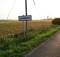
- Langrick village edge - geograph.org.uk - 460892.jpg 640 × 607; 92 KB
- Road Sign on High Street, Little Bytham - geograph.org.uk - 1627376.jpg 480 × 640; 124 KB
- Ministry of Defence Road Sign.jpg 1,578 × 602; 433 KB
- North Cotes - geograph.org.uk - 680038.jpg 640 × 427; 63 KB
- North Lincolnshire sign.jpg 3,024 × 4,032; 3.47 MB
- Old milestone - geograph.org.uk - 1461307.jpg 640 × 480; 116 KB
- Old Woodhall - geograph.org.uk - 464495.jpg 640 × 464; 86 KB
- Overgate Road into Swayfield - geograph.org.uk - 934984.jpg 640 × 536; 106 KB
- "Slow Down, Me Duck" - geograph.org.uk - 521198.jpg 640 × 480; 126 KB
- Potterhanworth Fen - geograph.org.uk - 434005.jpg 640 × 475; 141 KB
- Public footpath signs, near Morton - geograph.org.uk - 643076.jpg 640 × 480; 111 KB
- Road Sign, Grimsby - DSC07282.JPG 2,736 × 3,648; 3.55 MB
- Road works sign on A46 Clee Road, North East Lincolnshire - DSC07321.JPG 3,648 × 2,736; 3.58 MB
- Signpost this way to Scampton - geograph.org.uk - 1422604.jpg 640 × 475; 128 KB
- Silk Willoughby - panoramio.jpg 2,816 × 2,112; 2.88 MB
- Soft (or Soff) Lane Level Crossing - geograph.org.uk - 57548.jpg 640 × 480; 114 KB
- Staple Road, North Killingholme - geograph.org.uk - 1405391.jpg 640 × 480; 70 KB
- The Lincolnshire Wolds signpost - geograph.org.uk - 443604.jpg 640 × 480; 93 KB
- The Mareham Lane ford - geograph.org.uk - 368085.jpg 640 × 480; 73 KB
- The Top of Mere Balk Lane - geograph.org.uk - 778067.jpg 640 × 480; 99 KB
- To Sleaford 20 - geograph.org.uk - 1186476.jpg 640 × 480; 90 KB
- To Spalding 2 - geograph.org.uk - 1186125.jpg 640 × 480; 120 KB
- Welcome to Barton - geograph.org.uk - 52149.jpg 640 × 488; 81 KB
- Welcome to Goxhill ^ - geograph.org.uk - 57636.jpg 640 × 464; 116 KB
- Weston Hills - geograph.org.uk - 651866.jpg 640 × 480; 65 KB
- Willoughby Road crossing - geograph.org.uk - 718586.jpg 640 × 427; 95 KB
- Approaching Sleaford - geograph.org.uk - 404618.jpg 640 × 500; 48 KB
- Bridge End - geograph.org.uk - 378871.jpg 640 × 442; 64 KB
- Clear Improvement - geograph.org.uk - 590480.jpg 640 × 480; 93 KB
- Clear Warning - geograph.org.uk - 404670.jpg 640 × 547; 70 KB
- Langrick Ahead - geograph.org.uk - 460946.jpg 640 × 480; 49 KB
- Leagate Road end - geograph.org.uk - 463288.jpg 640 × 480; 71 KB
- Optimistic^ - geograph.org.uk - 516973.jpg 640 × 427; 90 KB
- Sharp Bend Sign - geograph.org.uk - 316518.jpg 640 × 480; 145 KB
- Sharp Bend Sign Other Way - geograph.org.uk - 316523.jpg 640 × 480; 160 KB
- Shore Road, Garthorpe - geograph.org.uk - 43873.jpg 640 × 425; 117 KB
- Signs a-plenty - geograph.org.uk - 390118.jpg 640 × 480; 112 KB
- Stainfield Common - geograph.org.uk - 448496.jpg 2,816 × 1,880; 3.32 MB
- Sustrans Route Marker - geograph.org.uk - 505799.jpg 480 × 640; 98 KB
- Waiting for the squall to pass by - geograph.org.uk - 468742.jpg 640 × 480; 56 KB


_Lane_Level_Crossing_-_geograph.org.uk_-_57548.jpg/120px-Soft_(or_Soff)_Lane_Level_Crossing_-_geograph.org.uk_-_57548.jpg)


