Category:Roads
Jump to navigation
Jump to search
wide way leading from one place to another, especially one with a specially prepared surface which vehicles can use | |
| Upload media | |
| Instance of | road transport infrastructure |
|---|---|
| Subclass of | thoroughfare |
| Location | landmass |
| Has part or parts |
|
| Followed by |
|
| Different from |
|
Subcategories
This category has the following 44 subcategories, out of 44 total.
+
?
A
C
D
E
F
- Fake roads (3 F)
H
L
M
- Marsh Road (9 F)
- Median strip (51 F)
N
O
P
R
- Remote views of roads (28 F)
S
- Skid roads (empty)
- Sneckdowns (2 F)
- Stroads (18 F)
T
V
- Videos of roads (5 F)
Media in category "Roads"
The following 200 files are in this category, out of 1,197 total.
(previous page) (next page)- - panoramio (1584).jpg 1,536 × 2,048; 1.11 MB
- - panoramio (190).jpg 3,264 × 2,448; 2.2 MB
- - panoramio (3464).jpg 3,648 × 2,736; 3.22 MB
- - panoramio (4190).jpg 4,320 × 2,880; 4.29 MB
- - panoramio - Mario Hains.jpg 800 × 506; 218 KB
- ...а дорога тонкою лентою вьётся... (33765695344).jpg 3,872 × 2,592; 2.17 MB
- 00-02-31, animal sciences rd - panoramio.jpg 2,058 × 1,400; 2.75 MB
- 10-52³, Levitación - Levitation - Flickr - anieto2k.jpg 5,491 × 2,528; 6.24 MB
- 140423 MOLENTJESDREEF NEERKANT DEURNE ruiter op pad - horseman about.JPG 1,488 × 842; 790 KB
- 151碼頭 - panoramio (1).jpg 2,592 × 1,936; 1.92 MB
- 18 Bends.jpg 6,014 × 3,066; 6.58 MB
- 1st Main, Off Suranjan Das Road.jpg 4,160 × 3,120; 5.27 MB
- 2009year0346.jpg 1,600 × 1,200; 197 KB
- 2013, Elephant Curve, Yarnell Grade - panoramio (1).jpg 6,000 × 4,000; 6.78 MB
- 2013, Elephant Curve, Yarnell Grade - panoramio.jpg 6,000 × 4,000; 11 MB
- 2015-08-31-1098 q1(pp2) (21002136076).jpg 3,264 × 1,788; 1.21 MB
- 2017-09-12 IAA 2017 BMW by Olaf Kosinsky-56.jpg 5,184 × 3,456; 6.79 MB
- 20180802 184428 greenish.jpg 4,128 × 2,322; 2.79 MB
- 270219-1351 дорога домой.jpg 2,048 × 1,536; 416 KB
- 3-GIS lighted road broadband.jpg 675 × 368; 266 KB
- 307roadthai.jpg 1,477 × 1,108; 139 KB
- 3111 Roadthai.jpg 1,280 × 1,280; 133 KB
- 350Z (1) (807205177).jpg 1,434 × 862; 607 KB
- 5th Cross, Michaelpalya, BM Kaval, Off Suranjan Das Road HAL 1st Stage.jpg 3,120 × 4,160; 4.39 MB
- 75 Street Bridge - Wayne Gretzkz Drive - Edmonton, Canada (2022).jpg 4,032 × 3,024; 1.58 MB
- 9th Avenue and Faiz Ahmed Faiz Metro Bus Station.jpg 4,638 × 2,415; 4.26 MB
- A beautiful road with leaves falling.jpg 3,456 × 2,304; 3.12 MB
- A collection of stores along Kuomboka Dr road 1.jpg 1,944 × 2,592; 2.14 MB
- A collection of stores along Kuomboka Dr road 3.jpg 1,944 × 2,592; 2.29 MB
- A different shot of two fenced neighboring houses along Kuomboka Dr road.jpg 1,944 × 2,592; 2.42 MB
- A house along Chandamali Road.jpg 1,944 × 2,592; 2.29 MB
- A house on a corner that joins Chandamali and Lumumba Road.jpg 1,944 × 2,592; 1.96 MB
- A picture of a car moving on a bridge.jpg 3,022 × 3,037; 2.65 MB
- A Road filled with yellowish.jpg 3,456 × 4,608; 7.15 MB
- A Road Through the Forest PLC-HW-27.jpg 3,872 × 2,592; 9.55 MB
- A track with two different surfaces.jpg 4,160 × 3,120; 5.43 MB
- A Trail to Remember.jpg 720 × 960; 181 KB
- A View Of Kamal Canal (Kamal Wah) - panoramio.jpg 1,600 × 1,200; 1.06 MB
- A view of local road at Domjur area in Howrah, West Bengal.jpg 2,448 × 3,264; 2.63 MB
- A yellowish house with a green roof along Freedom avenue.jpg 1,944 × 2,592; 1.51 MB
- A34 underpass cheadle.jpg 3,024 × 4,032; 6.01 MB
- Aaron Burden 2017-01-02 (Unsplash YILmPSsn3T4).jpg 3,992 × 2,992; 10.63 MB
- AASHO Road Test 1958 - Loop 5.jpg 1,662 × 805; 110 KB
- AASHO Test Road Site.jpg 541 × 332; 37 KB
- Abdanhan handan katırcıoğluna giden yol - panoramio.jpg 3,264 × 2,448; 4.01 MB
- Agali-Mundanpara Road Attappadi.jpg 4,032 × 2,268; 6.23 MB
- Akenstakas muizas cels.png 3,024 × 4,032; 22.98 MB
- Alappuzha Bypass Aerial View 1.jpg 1,916 × 1,080; 387 KB
- Alappuzha Bypass Aerial View 2.jpg 1,898 × 1,080; 875 KB
- Aleja 3.jpg 3,809 × 2,499; 5.04 MB
- Ali-Curung country track.jpg 3,008 × 2,000; 3.46 MB
- Along The Road Noisy Trees And Silent Lances (226948181).jpeg 2,038 × 2,048; 1.35 MB
- Amazing Tree Landscape.jpg 4,608 × 3,456; 3.59 MB
- Amixelaietako tunela.jpg 4,160 × 2,340; 3.75 MB
- An Adventurous girl with the Herd.jpg 1,536 × 2,560; 1.62 MB
- Andykhan Bassey2.jpg 1,920 × 2,560; 1.97 MB
- Arendell Avenue, Looking South. Zebulon N.C.jpg 1,511 × 970; 496 KB
- Ariel view of Imo state.jpg 750 × 1,334; 228 KB
- Arrigaztelu-Galtzadako tunela.jpg 4,160 × 2,340; 4.04 MB
- Arrival at Bergen Airport, Flesland.jpg 5,472 × 3,080; 9.57 MB
- Arrow in the road (Unsplash).jpg 5,184 × 3,456; 12.59 MB
- Ascending Into the Storm PLC-HW-24.jpg 3,872 × 2,592; 7.2 MB
- Asian Institute of Technology - playfield, side canal.jpg 3,264 × 2,448; 6.03 MB
- Asian Institute of Technology - playground road.jpg 3,264 × 2,448; 5.75 MB
- Assawarikh street.jpg 1,600 × 1,200; 205 KB
- August, 1977. slide (7be0048202fa4af3b94386170b96a229).jpg 2,168 × 1,479; 913 KB
- Aurangabad Bihar city sky view.jpg 868 × 1,071; 204 KB
- Aut (53883126).jpeg 2,048 × 1,365; 1.27 MB
- Automobile on road as seen from Devil's Elbow, ca 1926 (PICKETT 290).jpg 768 × 605; 148 KB
- Autopista Florencio del Castillo, Curridabat.jpg 4,730 × 2,660; 7.81 MB
- Avenue No 2.jpg 3,637 × 2,728; 6.03 MB
- Avenue no 4.jpg 3,421 × 2,000; 4 MB
- Avtodoroga R-126.jpg 3,264 × 2,448; 3.43 MB
- Açores (7776491588).jpg 3,888 × 2,592; 3.04 MB
- B.P. Koirala Highway2.jpg 2,322 × 4,128; 2.52 MB
- B.P. Koirala Highway3.jpg 4,128 × 2,322; 3.37 MB
- B.P. Koirala Highway4.jpg 4,128 × 2,322; 3.34 MB
- B.P. Koirala Highway5.jpg 4,128 × 2,322; 3.25 MB
- B.P. Koirala Highway6.jpg 4,128 × 2,322; 3.09 MB
- B.P. Koirala Highway7.jpg 4,128 × 2,322; 2.52 MB
- B.P. Koirala Highway8.jpg 4,128 × 2,322; 2.62 MB
- B.P. Koirala Highway9.jpg 4,128 × 2,322; 2.57 MB
- B5300 April 2019 Closure.jpg 4,032 × 3,024; 4.26 MB
- Baarle Street Border.jpg 3,456 × 4,608; 4.83 MB
- Bad road in lagos Nigeria 2020 07 02.jpg 4,128 × 2,322; 3.09 MB
- Bairro serra negra Nazaré pta - estrada congestionamento.jpg 3,000 × 4,000; 5.89 MB
- Ballywindelland Road (geograph 3637661).jpg 3,648 × 2,736; 6.58 MB
- Barehsar (6).jpg 640 × 388; 87 KB
- Barn off 93 - panoramio.jpg 3,264 × 2,200; 1.2 MB
- Baro Karfakor Primary School - panoramio.jpg 922 × 691; 389 KB
- Basataundiko tunela.jpg 4,160 × 2,340; 3.89 MB
- Beachforest Dirt Road.jpg 1,836 × 3,264; 2.17 MB
- Bealach na ba hairpin bend.jpg 4,000 × 3,000; 4.37 MB
- Bealach na ba.jpg 4,000 × 3,000; 3.47 MB
- Beautiful road 2.jpg 624 × 1,280; 158 KB
- Beautiful road.jpg 4,000 × 3,000; 8.28 MB
- Beautiful Roads through CPCRI, Vitla in summer.jpg 720 × 1,280; 327 KB
- Beautiful stone.jpg 3,000 × 4,000; 8.27 MB
- Beestenmarkt Deventer in ansicht met paard en wagen.jpg 542 × 357; 47 KB
- Before clearing. October, 1978. slide (5f103ff3da2e4ee9aa888a5c70bd6be8).jpg 2,168 × 1,479; 705 KB
- Ben sror mssila Algérie.jpg 3,120 × 4,160; 3.17 MB
- Berkendara.jpg 3,456 × 5,184; 7.06 MB
- Bhvdr3.jpg 3,264 × 2,448; 2.6 MB
- Bierašova street - panoramio.jpg 600 × 406; 67 KB
- Big soldier in the wood - panoramio.jpg 2,816 × 2,112; 2.4 MB
- Blow-off snow fence-05-02(Self standing type,Partially assembled,summer).jpg 4,000 × 3,000; 4.37 MB
- Blow-off snow fence-06(Various self standing type).jpg 4,000 × 3,000; 5.47 MB
- Blow-up prevention type snow fence-01.jpg 4,000 × 3,000; 7.81 MB
- Blowing-proof snow fence-02(summer).jpg 4,000 × 3,000; 5.78 MB
- Blue and greens.jpg 4,608 × 3,456; 6.32 MB
- Boneheaded (8581102874).jpg 3,264 × 1,836; 1.77 MB
- Boromarajajonani.jpg 1,279 × 1,280; 192 KB
- Brackenstown.jpg 4,096 × 2,304; 1.88 MB
- Bragança2.jpg 1,819 × 1,213; 1.27 MB
- Bragança3.jpg 1,825 × 1,217; 1.37 MB
- Bridge (37550c2ff0fb4125a37913c7fef3b594).jpg 2,140 × 1,457; 1.04 MB
- Bridge from Rumeli Castle Side.jpg 1,087 × 564; 189 KB
- Bridge over the river Paska.jpg 3,032 × 1,928; 3.67 MB
- Brösarps backar - panoramio.jpg 1,600 × 1,200; 689 KB
- BSRR Construction.jpg 6,000 × 3,778; 4.78 MB
- Buffered lane rendering.png 486 × 423; 8 KB
- Build a road.jpg 5,184 × 3,456; 6.66 MB
- Bus stop William pkwy 01.jpg 1,600 × 1,200; 813 KB
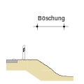
- Böschung.svg 400 × 400; 15 KB
- CA-180 East.jpg 4,032 × 3,024; 2.58 MB
- Camino a Guadal.JPG 1,600 × 1,200; 293 KB
- Camping Kratzmühle - Kinding - panoramio.jpg 2,048 × 1,536; 1.47 MB
- Carrefour Gas bottles.jpg 4,032 × 3,024; 7.95 MB
- Carretera de Asturias en Invierno.jpg 1,506 × 2,026; 1.73 MB
- Carretera nublada.jpg 3,264 × 2,448; 1.46 MB
- CARRETERA-HACIA VILLA NUEVA.JPG 1,920 × 1,080; 1.37 MB
- Cartel al inicio de la ruta 51.jpg 4,000 × 2,664; 2.69 MB
- CBD of Windhoek.jpg 3,138 × 2,448; 1.97 MB
- Ccnciones andinas del peru.JPG 450 × 302; 31 KB
- Cerro de los siete colores - Purmamarca - Juyjuy - Argentina - panoramio.jpg 5,044 × 2,044; 1.31 MB
- Cheeseland 3 mi → - panoramio.jpg 2,304 × 1,728; 1.62 MB
- Chemin de la Luge.jpg 3,024 × 4,032; 6.93 MB
- Chemin du lac Joanès et Vaudray - panoramio.jpg 3,872 × 2,592; 4.89 MB
- Chemins 2017 02.jpg 3,648 × 2,736; 3.13 MB
- Chinchu Bazar.jpg 4,608 × 3,456; 7.26 MB
- Chindyanovo village (Kende vele). Mordovia. Road in village.jpg 1,936 × 2,592; 2.4 MB
- Chindyanovo village (Kende vele). Mordovia. Road to neighboring village.jpg 1,936 × 2,592; 1.91 MB
- Chine Dr Sign.jpg 3,024 × 4,032; 2.08 MB
- Chine Drive 2.jpg 3,024 × 4,032; 4.79 MB
- Chine Drive 3.jpg 3,024 × 4,032; 4.37 MB
- Chine Drive.jpg 3,024 × 4,032; 3.91 MB
- Chinmay ashram (9).jpg 274 × 206; 19 KB
- Chittagong Night Shot.jpg 1,024 × 679; 116 KB
- Chittagong Nursing College Road.jpg 4,000 × 2,250; 5.79 MB
- Cidade de Viradouro - panoramio.jpg 2,048 × 1,536; 501 KB
- Circunvalacion de Rosario.jpg 3,983 × 2,777; 3.01 MB
- Ciudad En Las Nubes (70667899).jpeg 2,048 × 1,330; 701 KB
- Cloudy Mountain Road.jpg 1,268 × 1,024; 1.26 MB
- Columbia Gorge (10488335886).jpg 2,048 × 1,536; 991 KB
- Commercial Road.jpg 4,032 × 3,024; 3.3 MB
- Compacted forest track no1.jpg 3,264 × 2,448; 2.07 MB
- Concrete base for asphalt pavement.jpg 4,032 × 3,024; 3.94 MB
- Connemara landscape in The Inagh Valley.jpg 3,000 × 1,992; 2.05 MB
- Corniche des Etangs de Woluwe.jpg 3,024 × 4,032; 7.07 MB
- Costipatore manuale battente .jpg 1,087 × 1,879; 1.39 MB
- Country road in valle Argentera - panoramio.jpg 3,456 × 2,304; 7.4 MB
- Country road.jpg 2,304 × 4,096; 3.01 MB
- Court road, Mandya.jpg 3,000 × 4,000; 9.02 MB
- COVEC CHC i80 GNSS setup for Tambul-Mendi road profile.jpg 2,048 × 1,536; 1.22 MB
- COVEC CHC i80 GNSS setup for Tambul-Mendi road.jpg 2,048 × 1,536; 1.09 MB
- COVID-19 lock down day 13 , Accra.jpg 2,128 × 4,608; 5.33 MB
- COVID-19 lock down day 17 , Accra.jpg 2,128 × 4,608; 4.24 MB
- COVID-19 lock down day 20 , Accra.jpg 2,128 × 4,190; 4.81 MB
- COVID-19 lock down day 23 , Accra.jpg 4,608 × 2,128; 5.63 MB
- Cristina la jardin botanique.jpg 1,080 × 1,080; 198 KB
- Crossing Manning Park (3946285186).jpg 1,632 × 1,224; 1.67 MB
- Culleramovilcoche.jpg 1,920 × 2,560; 697 KB
- Cycling on the roads in the uk.jpg 4,000 × 2,667; 1.07 MB
- Cycling on the roads with a learner l plate on bike.jpg 4,000 × 2,667; 847 KB
- Cycling on the roads.jpg 4,000 × 2,667; 1.78 MB
- Daringbadi,orissa.jpg 4,640 × 3,480; 6.27 MB
- Dark Storm a Curve Ahead PLC-HW-23.jpg 3,872 × 2,592; 6.9 MB
- Dated 111981. slide (265c3ed51a4744faa35158c2cc63f060).jpg 2,140 × 1,457; 1.06 MB
- Desert Road.jpg 3,648 × 2,736; 8.71 MB
- Dev's Img2.jpg 5,184 × 3,456; 4.5 MB
- Dharan road.jpg 2,560 × 1,536; 941 KB
- Diagram Busway.png 2,000 × 2,000; 47 KB
- Diagram Zona selamat sekolah.png 1,988 × 932; 87 KB
- Digha road SH57.jpg 3,120 × 4,160; 4.32 MB
- Dingley Bypass & Mornington Peninsula Freeway.jpg 3,367 × 1,894; 892 KB
- Dirt road 2.jpg 2,340 × 4,160; 2.85 MB
- Dirt Road.jpg 3,264 × 2,448; 3.34 MB
- Dirty compacted forest track no1.jpg 3,264 × 2,448; 3.02 MB
.JPG/250px-Slezsk%c3%a9_Beskydy_-_Ryt%c3%ad%c5%99sk%c3%a1_stezka_(cesta_N%c3%bddek_-_Velk%c3%a1_%c4%8cantoryje).jpg)
.jpg/90px--_panoramio_(1584).jpg)
.jpg/120px--_panoramio_(190).jpg)
.jpg/120px--_panoramio_(3464).jpg)
.jpg/120px--_panoramio_(4190).jpg)

.jpg/120px-...%d0%b0_%d0%b4%d0%be%d1%80%d0%be%d0%b3%d0%b0_%d1%82%d0%be%d0%bd%d0%ba%d0%be%d1%8e_%d0%bb%d0%b5%d0%bd%d1%82%d0%be%d1%8e_%d0%b2%d1%8c%d1%91%d1%82%d1%81%d1%8f..._(33765695344).jpg)


.jpg/120px-151%e7%a2%bc%e9%a0%ad_-_panoramio_(1).jpg)


.jpg/120px-2013%2c_Elephant_Curve%2c_Yarnell_Grade_-_panoramio_(1).jpg)

_(21002136076).jpg/120px-2015-08-31-1098_q1(pp2)_(21002136076).jpg)


_(807205177).jpg/120px-350Z_(1)_(807205177).jpg)

.jpg/120px-75_Street_Bridge_-_Wayne_Gretzkz_Drive_-_Edmonton%2c_Canada_(2022).jpg)




_-_panoramio.jpg/120px-A_View_Of_Kamal_Canal_(Kamal_Wah)_-_panoramio.jpg)


.jpg/120px-Aaron_Burden_2017-01-02_(Unsplash_YILmPSsn3T4).jpg)


.jpeg/119px-Along_The_Road_Noisy_Trees_And_Silent_Lances_(226948181).jpg)


.jpg/120px-Arrow_in_the_road_(Unsplash).jpg)


.jpg/120px-August%2c_1977._slide_(7be0048202fa4af3b94386170b96a229).jpg)

.jpeg/120px-Aut_(53883126).jpg)
.jpg)
.jpg)
.18f44.delaye)


.jpg/120px-A%c3%a7ores_(7776491588).jpg)


.jpg/120px-Ballywindelland_Road_(geograph_3637661).jpg)

.jpg/120px-Barehsar_(6).jpg)


.jpg)


.jpg)
.jpg/120px-Blow-off_snow_fence-06(Various_self_standing_type).jpg)

.jpg/120px-Blowing-proof_snow_fence-02(summer).jpg)

.jpg/120px-Boneheaded_(8581102874).jpg)
.1)


.jpg/120px-Bridge_(37550c2ff0fb4125a37913c7fef3b594).jpg)






._Mordovia._Road_in_village.jpg/90px-Chindyanovo_village_(Kende_vele)._Mordovia._Road_in_village.jpg)
._Mordovia._Roa/90px-Chindyanovo_village_(Kende_vele)._Mordovia._Road_to_neighboring_village.jpg)


.jpg/120px-Chinmay_ashram_(9).jpg)


.jpg/120px-Chuckanut_Drive_near_Bellingham%2c_Washington%2c_ca_1926_(WASTATE_726).jpg)


.jpeg/120px-Ciudad_En_Las_Nubes_(70667899).jpg)

.jpg/120px-Columbia_Gorge_(10488335886).jpg)


.jpg/120px-Crossing_Manning_Park_(3946285186).jpg)


.jpg/120px-Dated_111981._slide_(265c3ed51a4744faa35158c2cc63f060).jpg)


