Category:Sewstern Lane
Jump to navigation
Jump to search
Media in category "Sewstern Lane"
The following 24 files are in this category, out of 24 total.
- Beck Farm, Sewstern Lane near Foston - geograph.org.uk - 301193.jpg 640 × 480; 78 KB
- Bridge on the Denton Branch - geograph.org.uk - 1464901.jpg 640 × 480; 173 KB
- Churchyard stile - geograph.org.uk - 1045459.jpg 640 × 427; 101 KB
- Farmland near Bottesford - geograph.org.uk - 153253.jpg 640 × 427; 123 KB
- Farmland near Thackson's Well Farm - geograph.org.uk - 1031447.jpg 640 × 480; 91 KB
- Farmland near Thackson's Well Farm - geograph.org.uk - 301629.jpg 640 × 427; 77 KB
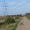
- Heading north along Sewstern Lane - geograph.org.uk - 1031610.jpg 640 × 481; 103 KB
- Heading south along the Viking Way - geograph.org.uk - 1031529.jpg 640 × 551; 121 KB
- New Cottages, Sewstern Lane, near Denton - geograph.org.uk - 67694.jpg 640 × 480; 190 KB
- Sewstern Lane - geograph.org.uk - 1030087.jpg 640 × 427; 102 KB
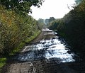
- Sewstern Lane - geograph.org.uk - 1030119.jpg 640 × 427; 111 KB
- Sewstern Lane and the Viking Way - geograph.org.uk - 1031467.jpg 640 × 357; 59 KB
- Sewstern Lane near Allington - geograph.org.uk - 180158.jpg 640 × 427; 119 KB
- Sewstern Lane near Foston - geograph.org.uk - 301227.jpg 640 × 427; 62 KB
- Sewstern Lane near Muston and Stenwith - geograph.org.uk - 153261.jpg 640 × 427; 145 KB
- Sewstern Lane near Woolsthorpe - geograph.org.uk - 151994.jpg 640 × 427; 181 KB
- Sewstern Lane, Sedgebrook, Lincolnshire (geograph 3558897).jpg 640 × 427; 124 KB
- Sewstern Lane.jpg 640 × 427; 115 KB
- Thackson's Well Farm - geograph.org.uk - 301592.jpg 640 × 427; 93 KB
- The Viking Way near Allington - geograph.org.uk - 180183.jpg 640 × 427; 126 KB
- Unmanned Level Crossing near Muston - geograph.org.uk - 153250.jpg 640 × 427; 134 KB


.jpg/120px-Sewstern_Lane%2c_Sedgebrook%2c_Lincolnshire_(geograph_3558897).jpg)


