Category:Wales
Jump to navigation
Jump to search
 This category is about the country. For other uses, see Category:Wales (disambiguation).
Constituent countries of the United Kingdom: England · Northern Ireland · Scotland · Wales – British Crown dependencies: Guernsey · Isle of Man · Jersey
British overseas territories: Akrotiri and Dhekelia · Anguilla · Bermuda · British Antarctic Territory · British Indian Ocean Territory · British Virgin Islands · Cayman Islands · Falkland Islands · Gibraltar · Pitcairn Islands · Saint Helena, Ascension and Tristan da Cunha · South Georgia and the South Sandwich Islands · Turks and Caicos Islands
British overseas territories: Akrotiri and Dhekelia · Anguilla · Bermuda · British Antarctic Territory · British Indian Ocean Territory · British Virgin Islands · Cayman Islands · Falkland Islands · Gibraltar · Pitcairn Islands · Saint Helena, Ascension and Tristan da Cunha · South Georgia and the South Sandwich Islands · Turks and Caicos Islands
country in north-west Europe, part of the United Kingdom | |
| Upload media | |
| Instance of | constituent country of the United Kingdom, nation, country |
|---|---|
| Part of | Celtic nations |
| Patron saint | |
| Location | United Kingdom, United Kingdom |
| Capital |
|
| Legislative body | |
| Executive body | |
| Official language | |
| Anthem | |
| Currency |
|
| Head of government |
|
| Has part or parts |
|
| Start time | 5th century |
| Inception |
|
| Highest point | |
| Population |
|
| Area |
|
 | |
|
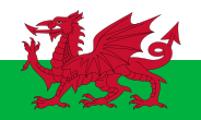
Wales is one of the four nations of the United Kingdom of Great Britain and Northern Ireland. |
Subcategories
This category has the following 26 subcategories, out of 26 total.
!
- Gallery pages of Wales (12 P)
?
A
B
C
- Contrails in Wales (2 F)
E
F
G
H
I
M
N
O
P
R
S
U
- Users in Wales (4 P)
V
Τ
Media in category "Wales"
The following 200 files are in this category, out of 863 total.
(previous page) (next page)- 20140817 I27 Pantygelli (14928851007).jpg 5,184 × 3,888; 9.48 MB
- 20140817 S16 Pantygelli (14928704220).jpg 3,648 × 2,736; 5.7 MB
- 2019 Greenhouse gas emission in Wales.png 1,220 × 746; 484 KB
- 20200512 Castell Meredydd 3.jpg 4,032 × 2,016; 2.47 MB
- 20210630 111847-PANO.jpg 1,920 × 639; 540 KB
- 203 fd hosp200.png 200 × 200; 14 KB
- A bunkering supplier in Holyhead Harbour - geograph.org.uk - 2240820.jpg 1,024 × 704; 119 KB
- A former gun emplacement on Pen-ychain - geograph.org.uk - 1821158.jpg 1,024 × 768; 252 KB
- A geo on the western side of the natural arch - geograph.org.uk - 2055625.jpg 1,024 × 752; 202 KB
- A last view of the Blessed Isle of Enlli - geograph.org.uk - 2143294.jpg 1,024 × 758; 94 KB
- A Nefyn lobster boat off Porth Gwylan - geograph.org.uk - 2122109.jpg 1,024 × 745; 167 KB
- A5 Sunset (28052199144).jpg 5,472 × 3,648; 2.77 MB
- A5 Sunset (28052261874).jpg 3,648 × 5,472; 3.29 MB
- A5 Sunset (28053279973).jpg 15,037 × 3,153; 29.35 MB
- A5 Sunset (28053282433).jpg 3,494 × 5,241; 3.42 MB
- A5 Sunset (28637401386).jpg 5,472 × 3,648; 3.11 MB
- A5 Sunset (28637403486).jpg 3,648 × 5,472; 3.66 MB
- A5 Sunset (28637405706).jpg 5,472 × 3,648; 3.59 MB
- A5 Sunset (28669471185).jpg 3,648 × 5,472; 3.42 MB
- Aber Geirch - geograph.org.uk - 2147367.jpg 640 × 480; 42 KB
- Abermyharan, Ramsey Island - geograph.org.uk - 1868734.jpg 640 × 427; 73 KB
- Aberthaw Power Station Water Outfalls - geograph.org.uk - 2818080.jpg 2,200 × 542; 816 KB
- Aberystwyth - View from Summit Station - geograph.org.uk - 3185240.jpg 1,333 × 1,000; 962 KB
- Aberystwyth North Beach, early morning - geograph.org.uk - 2996611.jpg 1,024 × 768; 113 KB
- Aberystwyth, next stop Dublin - geograph.org.uk - 3234109.jpg 768 × 1,024; 125 KB
- Above the Green Bridge of Wales - geograph.org.uk - 3449801.jpg 640 × 480; 116 KB
- Across the incoming tide to a small sandbank - geograph.org.uk - 2558969.jpg 1,469 × 1,102; 291 KB
- Aerial view of Cemaes Head - geograph.org.uk - 3417786.jpg 3,072 × 2,304; 3.55 MB
- Air sea rescue helicopter over Conwy estuary - geograph.org.uk - 2389146.jpg 1,600 × 1,200; 280 KB
- Amwisg golau carthen Gymreig.jpg 4,608 × 3,456; 3.6 MB
- Angle Bay - geograph.org.uk - 2027878.jpg 1,600 × 977; 392 KB
- Anticline at Pen-y-holt Down - geograph.org.uk - 2385127.jpg 2,592 × 1,944; 2.23 MB
- Armorial Achievement Jeffrey Thomas.jpg 1,275 × 1,590; 180 KB
- At The Edge Of The Waterfall (23210989435).jpg 5,472 × 3,648; 12.1 MB
- Autumn Landscape and House (enhanced).jpg 960 × 539; 94 KB
- Awaken the Dragon finale Snowdon.jpg 1,503 × 1,703; 322 KB
- Bae Aberdaron Bay from near Pen y Cil - geograph.org.uk - 2138796.jpg 1,024 × 768; 141 KB
- Baltic Sun II - geograph.org.uk - 3558615.jpg 800 × 451; 183 KB
- Bancroft Painting.jpg 2,736 × 3,648; 5.96 MB
- Bando stick.jpg 450 × 587; 17 KB
- Baneri Prom Aber Catalwnia, Basgtir.jpg 2,999 × 2,171; 774 KB
- Bangor Pier - geograph.org.uk - 3554166.jpg 1,600 × 1,064; 503 KB
- Barafundle Bay - geograph.org.uk - 3530791.jpg 640 × 426; 82 KB
- Beach on SE coast of Ynys Llanddwyn - geograph.org.uk - 3341805.jpg 1,600 × 1,200; 348 KB
- Belgian Promenade, House, ^ Menai Suspension Bridge - geograph.org.uk - 3177399.jpg 3,648 × 2,736; 3.92 MB
- Betsan Cwtsh.jpg 1,500 × 500; 114 KB
- BigCovert01LB.jpg 2,816 × 2,112; 3.83 MB
- Black Rock Sands - geograph.org.uk - 1965330.jpg 1,046 × 1,664; 249 KB
- Blaenau Beauty.jpg 960 × 720; 174 KB
- Blaenau Tunnel (48206487262).jpg 4,972 × 3,315; 12.53 MB
- Blowing in the wind - geograph.org.uk - 2511666.jpg 640 × 489; 135 KB
- Bluestone National Park Resort nature trail.jpg 3,840 × 5,120; 9.74 MB
- Boat approaching - geograph.org.uk - 3555503.jpg 640 × 480; 97 KB
- Boats in the marina - geograph.org.uk - 2592732.jpg 640 × 480; 99 KB
- Breaking waves - geograph.org.uk - 1844181.jpg 640 × 480; 82 KB
- Bridge and stepped path to South Stack Lighthouse - geograph.org.uk - 2738088.jpg 1,500 × 1,125; 1.89 MB
- Bridge leading to the jetty at Doc Bach - geograph.org.uk - 2070988.jpg 1,024 × 577; 134 KB
- Bro Granite at Milford Haven - geograph.org.uk - 3123204.jpg 4,000 × 3,000; 2.31 MB
- Broad Haven view - geograph.org.uk - 2398403.jpg 2,592 × 1,944; 2.13 MB
- Bryn Pydew Village.jpg 4,032 × 3,024; 3.09 MB
- Bullslaughter Bay - geograph.org.uk - 3449704.jpg 640 × 480; 77 KB
- Bws a bwsfa, Aberystwyth.jpg 4,160 × 3,120; 3.5 MB
- Bws Traws Cymru ochr.jpg 4,160 × 3,120; 3.69 MB
- Bwsfa Aberystwyth 2.jpg 4,160 × 3,120; 4.49 MB
- Bwsfa Aberystwyth.jpg 4,160 × 3,120; 4.4 MB
- Cadair Ifan Goch.jpg 3,072 × 2,304; 1.74 MB
- Cae Padarn Utd.jpg 4,160 × 3,120; 4.52 MB
- Caer'r Nant Stone Quarry (48445239546).jpg 5,398 × 3,623; 14.87 MB
- Caer'r Nant Stone Quarry (48445244231).jpg 4,904 × 3,269; 12.86 MB
- Caer'r Nant Stone Quarry (48445381332).jpg 5,435 × 3,623; 15.7 MB
- CaerdyddBUA.png 750 × 850; 879 KB
- Caernarfon Bay viewed from Porth Ruffydd - geograph.org.uk - 2606682.jpg 3,256 × 2,313; 3.09 MB
- Caldey Point and Spur Island - geograph.org.uk - 1880929.jpg 640 × 480; 52 KB
- Canoeing on the Menai Strait - geograph.org.uk - 1970020.jpg 640 × 479; 95 KB
- Cardigan Island and yacht - geograph.org.uk - 3560611.jpg 640 × 427; 45 KB
- Careg Wylan at low tide - geograph.org.uk - 2302404.jpg 1,600 × 1,200; 546 KB
- Careg Wylan at low tide - geograph.org.uk - 3014007.jpg 4,000 × 3,000; 3.43 MB
- Careg Yspar and the Witch's Cauldron - geograph.org.uk - 3417684.jpg 2,304 × 3,072; 3.48 MB
- Carreg Gybi - geograph.org.uk - 2106899.jpg 1,600 × 1,205; 635 KB
- Carreg Lydan and Cardigan Island - geograph.org.uk - 2452559.jpg 1,229 × 922; 322 KB
- Carreg yr Afr - geograph.org.uk - 2985606.jpg 3,199 × 4,116; 3.48 MB
- Castlemartin - 1984 - geograph.org.uk - 2374844.jpg 2,272 × 1,514; 561 KB
- Castlemartin - 1988 - geograph.org.uk - 3310546.jpg 2,272 × 1,515; 524 KB
- Castlemartin - 1988 - geograph.org.uk - 3310547.jpg 2,272 × 1,515; 592 KB
- Cattle drive (20690258058).jpg 4,557 × 3,038; 10.55 MB
- Cave on Ramsey Island - geograph.org.uk - 2056900.jpg 640 × 480; 93 KB
- Cave on St. Tudwal's Island East - geograph.org.uk - 3452014.jpg 4,000 × 3,000; 3.23 MB
- Caves at Jack Sound - geograph.org.uk - 2401262.jpg 1,024 × 671; 186 KB
- Caves on St. Tudwal's Island East - geograph.org.uk - 3452035.jpg 4,000 × 3,000; 3.35 MB
- Caves on the north side of Porth Meudwy - geograph.org.uk - 2138136.jpg 1,024 × 644; 163 KB
- CefnMawr01LB.jpg 2,816 × 2,112; 2.19 MB
- Cei-bach bay - geograph.org.uk - 1837477.jpg 1,600 × 1,165; 647 KB
- Ceibwr Bay from the southwest - geograph.org.uk - 3612626.jpg 2,560 × 1,750; 2.24 MB
- Central sandbank - geograph.org.uk - 2496008.jpg 640 × 480; 97 KB
- Cerrig Gwylan - geograph.org.uk - 2097709.jpg 1,024 × 753; 140 KB
- Cerrig Gwylan From a Lichen-encrusted Mainland - geograph.org.uk - 2983290.jpg 3,216 × 4,288; 3.09 MB
- Cerrig Wylan - geograph.org.uk - 3158016.jpg 640 × 480; 60 KB
- Cerrig Wylan - geograph.org.uk - 3158023.jpg 640 × 480; 89 KB
- Cerrig y Barcdy - geograph.org.uk - 2219389.jpg 2,000 × 1,500; 683 KB
- Channel in front of Cardigan Island - geograph.org.uk - 3560597.jpg 640 × 427; 67 KB
- Chapel Point, Caldey Island - geograph.org.uk - 1880921.jpg 640 × 480; 54 KB
- Church Rock - geograph.org.uk - 2398388.jpg 2,592 × 1,944; 1.82 MB
- Clarach Bay in the Distance - geograph.org.uk - 3409402.jpg 1,600 × 917; 219 KB
- Clarach Bay, looking south - geograph.org.uk - 2154970.jpg 640 × 480; 51 KB
- Clement Colley Walk - geograph.org.uk - 1832786.jpg 1,200 × 1,600; 441 KB
- Cliff scenery north of Newton Saddle - geograph.org.uk - 2154833.jpg 1,024 × 768; 241 KB
- Cliff top view across Newport Bay - geograph.org.uk - 3007635.jpg 4,000 × 3,000; 3.4 MB
- Cliff top view towards Worms Head - geograph.org.uk - 2118439.jpg 640 × 480; 47 KB
- Cliff-top above Ogof Gathwen - geograph.org.uk - 2141661.jpg 1,024 × 767; 240 KB
- Cliffs and wave-cut platforms at Clarach - geograph.org.uk - 2154936.jpg 480 × 640; 106 KB
- Cliffs at Bwa Gwyn - geograph.org.uk - 1890420.jpg 427 × 640; 255 KB
- Cliffs at Pen y Cil - geograph.org.uk - 2915675.jpg 640 × 425; 69 KB
- Cliffs at Renney Slip - geograph.org.uk - 1875965.jpg 640 × 480; 136 KB
- Cliffs Near Bwa Gwyn - geograph.org.uk - 1890408.jpg 427 × 640; 255 KB
- Cliffs near Rhoscolyn - geograph.org.uk - 1897795.jpg 640 × 427; 252 KB
- Cliffs north of Clarach - geograph.org.uk - 2251410.jpg 640 × 480; 156 KB
- Cliffs, Aber Geirch - geograph.org.uk - 2147369.jpg 480 × 640; 80 KB
- Cliffs, Black Rock Sands - geograph.org.uk - 2951620.jpg 640 × 439; 42 KB
- Cliffs, Great Orme's Head - geograph.org.uk - 2428238.jpg 1,280 × 960; 697 KB
- Cloudy Brecon Beacons.jpg 1,500 × 1,004; 1.8 MB
- Coast near Castell Bach - geograph.org.uk - 2064362.jpg 1,600 × 1,121; 652 KB
- Coast near Coybal - geograph.org.uk - 2296355.jpg 3,072 × 2,097; 3.62 MB
- Coast near Saddle Head - geograph.org.uk - 2398463.jpg 1,280 × 960; 571 KB
- Coast near South Stack - geograph.org.uk - 1898505.jpg 640 × 394; 199 KB
- Coast near St. Govan's chapel - geograph.org.uk - 2056431.jpg 480 × 640; 98 KB
- Coast path to Freshwater West - geograph.org.uk - 2027860.jpg 1,600 × 1,195; 546 KB
- Coast view at Penmon - geograph.org.uk - 2530094.jpg 1,024 × 768; 126 KB
- Coastal Headland near St. Mary's Well - geograph.org.uk - 2761068.jpg 1,024 × 743; 221 KB
- Coastal scene near Ynys-Lochtyn - geograph.org.uk - 3076038.jpg 640 × 480; 72 KB
- Coastal scenery northwards of Pen-ychain Point - geograph.org.uk - 1844378.jpg 1,024 × 585; 144 KB
- Coastal view towards Newton Saddle - geograph.org.uk - 3202714.jpg 3,132 × 4,240; 2.36 MB
- Coastline and cliffs - geograph.org.uk - 3449662.jpg 640 × 480; 107 KB
- Coastline at Saint Govan's Head - geograph.org.uk - 2398437.jpg 960 × 1,280; 558 KB
- Coastline near Trearddur Bay - geograph.org.uk - 2616010.jpg 3,264 × 2,448; 2.99 MB
- Coastline up to Pen Tew - geograph.org.uk - 3560601.jpg 640 × 427; 47 KB
- Coat-of-arms-st-davids.jpg 5,348 × 3,427; 10.88 MB
- Collapsed stack at the Cabin Door - geograph.org.uk - 2385153.jpg 1,280 × 960; 584 KB
- Conwy Estuary - geograph.org.uk - 3352526.jpg 800 × 530; 100 KB
- Conwy Valley (29001475152).jpg 5,472 × 3,648; 3.99 MB
- Cormorant's Rest - geograph.org.uk - 2317245.jpg 2,272 × 1,704; 1.11 MB
- Cormorants on Cardigan Island - geograph.org.uk - 2390922.jpg 1,024 × 768; 145 KB
- Cortado gwyn.jpg 4,214 × 2,723; 2.82 MB
- Cottages from Bangor Pier - geograph.org.uk - 2139055.jpg 1,500 × 985; 119 KB
- Cove near Castell Bach - geograph.org.uk - 2065794.jpg 3,072 × 2,304; 1.61 MB
- Crab Bay and a cormorant - geograph.org.uk - 1857938.jpg 640 × 427; 72 KB
- Craft passing Pen y Cil headland - geograph.org.uk - 2483341.jpg 640 × 480; 64 KB
- Craggy coastline of South Pembrokeshire - geograph.org.uk - 3449604.jpg 640 × 480; 100 KB
- Criccieth Tiles (48206478322).jpg 4,468 × 2,979; 9.06 MB
- Crossing Menai Bridge - geograph.org.uk - 3203066.jpg 640 × 464; 80 KB
- Crow Rock - geograph.org.uk - 1825425.jpg 2,816 × 2,120; 1.41 MB
- Crow Rock and Linney Head - geograph.org.uk - 1828551.jpg 2,816 × 2,120; 1.42 MB
- Cwm Bach - geograph.org.uk - 3160288.jpg 640 × 480; 97 KB
- Cwpan Cymru - Welsh Cup.jpg 3,024 × 4,032; 2.48 MB
- Dale Roads - geograph.org.uk - 1841635.jpg 640 × 480; 103 KB
- DeesideBUA.png 850 × 850; 850 KB
- Diffib Aberystwyth.jpg 3,120 × 4,160; 4.11 MB
- Dinas Fach - geograph.org.uk - 2396595.jpg 640 × 480; 93 KB
- Dinas Head from Pen-y-Fan - geograph.org.uk - 1810517.jpg 4,224 × 3,168; 2.18 MB
- Doc Bach-Fish Dock at Holyhead - geograph.org.uk - 2070582.jpg 1,024 × 420; 72 KB
- Dock at Plas Newydd - geograph.org.uk - 2404123.jpg 1,024 × 662; 206 KB
- Dog heaven - geograph.org.uk - 2556890.jpg 1,664 × 1,248; 270 KB
- Downriver - geograph.org.uk - 2352148.jpg 640 × 402; 50 KB
- Dyddiadau hedfan morgrug, Cymru yn bennaf 1933-2010.jpg 903 × 615; 128 KB
- Eastern tip of Cardigan Island - geograph.org.uk - 3560599.jpg 640 × 427; 50 KB
- Easternmost point of St. Tudwal's Island East - geograph.org.uk - 3452022.jpg 4,000 × 3,000; 2.77 MB
- Elegug Stacks - geograph.org.uk - 3202657.jpg 3,226 × 3,212; 1.61 MB
- Elegug Stacks - geograph.org.uk - 3449777.jpg 640 × 480; 99 KB
- Elegug stacks and surrounding cliffs - geograph.org.uk - 2650361.jpg 4,000 × 3,000; 6.49 MB
- Elegug Stacks or Stack Rocks - geograph.org.uk - 3449787.jpg 640 × 480; 103 KB
- Elegug Stacks, South Pembrokeshire - geograph.org.uk - 3449783.jpg 640 × 480; 107 KB
- Elegug Stacks, Stack Rocks - geograph.org.uk - 2575347.jpg 2,592 × 1,944; 1.59 MB
- End Of Pier, Llandudno - geograph.org.uk - 3281616.jpg 2,560 × 1,920; 2.58 MB
- End of the pier amusements - geograph.org.uk - 2510272.jpg 640 × 480; 121 KB
- Entering Holyhead's Inner Harbour - geograph.org.uk - 1974298.jpg 1,024 × 753; 123 KB
- Entrance to the Harbour - geograph.org.uk - 3410799.jpg 3,840 × 2,046; 1.07 MB
- Eroded gully - geograph.org.uk - 1851305.jpg 640 × 480; 90 KB
- Erratic boulders uncovered by low tide - geograph.org.uk - 2218806.jpg 2,000 × 1,500; 505 KB
- Escudo Seleção Galesa de Futebol.png 225 × 225; 9 KB
- EuroGales.svg 512 × 538; 14 KB
- Evening Seascape, Ellins Tower, South Stack - geograph.org.uk - 3112276.jpg 3,000 × 2,000; 1.86 MB
- Eventide - Llantwit Major - geograph.org.uk - 2811661.jpg 2,880 × 2,021; 3.28 MB
- Exposed rock at Graig Ddu - geograph.org.uk - 2608599.jpg 3,872 × 2,592; 3.46 MB
.jpg/250px-Morfa_Harlech_National_Nature_Reserve_(22816405077).jpg)


.jpg/120px-20140817_I27_Pantygelli_(14928851007).jpg)
.jpg/120px-20140817_S16_Pantygelli_(14928704220).jpg)







.jpg/120px-A5_Sunset_(28052199144).jpg)
.jpg/80px-A5_Sunset_(28052261874).jpg)
.jpg/80px-A5_Sunset_(28053282433).jpg)
.jpg/120px-A5_Sunset_(28637401386).jpg)
.jpg/80px-A5_Sunset_(28637403486).jpg)
.jpg/120px-A5_Sunset_(28637405706).jpg)
.jpg/80px-A5_Sunset_(28669471185).jpg)


.jpg/120px-At_The_Edge_Of_The_Waterfall_(23210989435).jpg)
.jpg/120px-Autumn_Landscape_and_House_(enhanced).jpg)


.jpg/120px-Blaenau_Tunnel_(48206487262).jpg)


.jpg/120px-Caer%27r_Nant_Stone_Quarry_(48445239546).jpg)
.jpg/120px-Caer%27r_Nant_Stone_Quarry_(48445244231).jpg)
.jpg/120px-Caer%27r_Nant_Stone_Quarry_(48445381332).jpg)


.jpg/120px-Cattle_drive_(20690258058).jpg)


%2c_Pembrokesh/120px-Church_Rock_off_Broad_Haven_(South)%2c_Pembrokeshire_-_geograph.org.uk_-_3564677.jpg)


.jpg/120px-Conwy_Valley_(29001475152).jpg)


.jpg/120px-Criccieth_Tiles_(48206478322).jpg)


.jpg)


